Thursday, January 28, 2010

Las Vegas to Barstow CA


One stop I wanted make in Las Vegas was the Vegas Spring in North Las Vegas. Alonzo mentions it in his journal, “Drove 12 miles and reached the Vegas spring which was vegas to us indeed. The last five miles the road was very hard and our teams very weak. We left some 12 (animals) unable to travel forward without rest. The spring forms a large marsh and the frogs do squeak horrid.”

The Vegas spring was the most appreciated stopping place along the entire route. Simon Nunes Carvalho, another traveler of the Spanish Trail was more descriptive of the Vegas Spring than Alonzo, “The water bubbled up as if gas were escaping, acacias in full bloom almost entirely surrounded it—it was forty-five feet in diameter. . . . we found it to contain the clearest and purest water I ever tasted . . . the water was over fifteen feet in depth.” They laid over at the Vegas Spring for three days.

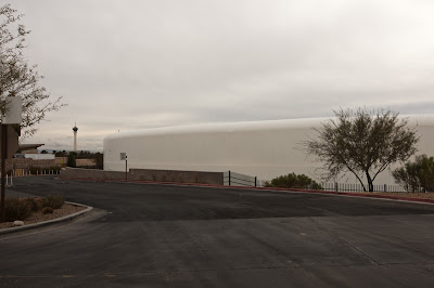
Today the spring, used by the water company, has been capped. Each cover is approximately one-hundred feet in diameter.

You can see a small spring in a man-made setting displayed for visitors. While you cannot camp there you can still have a meal at Wolfgang Pucks.

Click on photos to view a larger image

Spring in Current Setting


Vegas Spring Capped


Dining at Vegas Spring


Out of Las Vegas we took Hwy 159 through Blue Diamond then picked up Hwy 160 to continue our way west over the Mountain Spring summit.

Heading toward the Mountains


A Joshua Tree by the Road


Desert Landscape

From Mountain Spring Summit


About fifteen miles farther we turned west on the Old Spanish Trail, leaving Nevada behind and traveling through the Pahrump and California Valleys, and the Nopah and the Resting Spring Ranges. The riverbeds were empty, but would soon be filled with water from the approaching storm.

According to Alonzo’s journal he was at Resting Spring on January 18, “We left 22 oxen today on the road, . . .they were unable to travel farther.” They laid over on the 19th, and Alonzo mended his frying pan handle. We realized that we were in the same spot on the same day, but 160 years later.

Resting Spring before the Rain


A few miles west we came upon the small town of Tecopa, CA.


West of Tecopa near the Armagosa River


Approaching Storm


We could view the storm coming from the west, and experienced occasional light showers. After Tecopa we traveled west until we met Hwy 127 that goes north to Death Valley. We turned south through the desert passing the Armagosa Canyon, the Salt Spring Hills, and the Silurian Valley to the east. We were crossing areas of Death Valley.

On January 25th Alonzo noted, “This morning 13 of us started with our packs on our backs for the settlements. We traveled 2 miles the winds and sand were so high and dead ahead that we had to lay by. It is almost 150 miles to Williams Ranch (current day Chino CA) and thirty (more) to Pueblo (Los Angeles). It wants an iron man to travel this country . . .We started and traveled until 9OCK and lay our bones down in the desert to rest without water. It is mighty hard for a poor man.” By packing ahead they could travel faster, and would also benefit those left behind because the short supplies would go farther.

We could not follow the trail further west as the Fort Irwin Military Reservation occupies the land. As we neared I-15 at the town of Baker we passed the dry Silver Lake on the right, and the dry Soda Lake is on the left of I-15.

The Mojave River, which originates in the San Bernardino Mountains, flows east through the desert near Barstow and Victorville. The river can fill Silver and Soda Lakes during heavy flooding.

The storm had delivered the promised rain, and we continued on the Interstate until we reached Barstow where we had an excellent pizza and spent the night.

Driving in the Rain


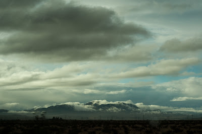
Clearing Skies near Barstow


Sunday, January 24, 2010

Mesquite NV to Las Vegas NV


On Monday, Jan. 18, 2010 we left Mesquite under ominous skies, and followed Hwy 170 along the Rio Virgin as did Alonzo and the Pomeroy Group. The Muddy River replaced the Rio Virgin and eventually empties into the present day Lake Mead, a man-made lake south of Las Vegas.

Click on photos for a larger image

Overcast Morning in Mesquite


The Rio Virgin


The Muddy River


Since we had a short-drive-day we decided to visit the Valley of Fire, a Nevada State Park.

Entering the Valley of Fire


Park Information


In the 1930s the CCC (Civilian Conservation Corps) built some cabins, for travelers passing thought the area, out of the native limestone.

Tourist Cabins


Cabin Fireplace


The landscape is truly remarkable and the colors, even on a dreary day, were brilliant. It is estimated that the valley was occupied from about 300 B.C. to 1150 A.D. Native Americans using the area range from the Basket Maker People and later the Anasazi Pueblo Farmers. Water is scarce in the valley so their stays would have been limited. Some excellent examples of Ancient Native American petroglyphs can be seen in various locations.

Mouse’s Tank was named for a renegade who used the area as a hideout in the 1890’s. It is a natural basin in the rock where water collects after rainfalls. Numerous examples of petroglyphs can be seen here

Road toward Mouse's Tank


Trail Leading to Mouse's Tank


Mouse's Tank


Petroglyphs


Emigrants passing this were unaware of the beautiful valley; they could not have navigated the terrain, and the lack of water would have made it an unattractive stopping place.

Rock Formations in the Valley of Fire

Align Center


Scenic Views


Looking for the Right Shot


Fire Canyon Sign


Silica Done Sign


We spent a good part of the day exploring the Valley of Fire, and finally left as the light was fading. We had entered on the east side of the park from Hwy169, but exited on the west side. We drove on I-15 to Las Vegas where we managed to spend the night without seeing a single slot machine.

Thursday, January 21, 2010

Parowan UT to Mesquite NV


The Parowan Gap Road continues east to Cedar City where Alonzo notes, “We have now struck the Old Spanish Trail . . . We shall probably follow this trail 2 or 3 hundred miles.”

The Spanish Trail followed a route south toward Cedar City, west of I-15. We backtracked on the Parowan Gap Road to Hwy 130 and drove south. My original intent had been to see the Shakespeare Theater in Cedar City, but that was not to be on this trip.

A little over fifty miles along the Spanish Trail from Little Salt Lake Alonzo wrote in his journal, “Our noon halt was on a little stream and to our astonishment we found a party of men. Not Fremont and his starving party in the mountains but Capt Smith and his party of men almost perished with hunger. Oh horror I pity the poor souls. They have been necessitated to kill and eat 11 mules and horses to sustain life. . . . The company attempted to make a cut off, and got lost in the Mts. From the Spanish Trail.”

At Iron Springs the trail runs northwest around the Antelope Range and then south to present day Newcastle. It is probably in the area north of Newcastle that they met Captain Smith’s group. We drove west on Hwy 56 where we met the Spanish Trail at Newcastle and turned south on Hwy 18.

It was just south of this area that Alonzo recorded, “All well but cold, the thermometer stood this morning at 11 below zero. That is rather cold. We are between 6 and 7 thousand feet above the Gulf of Mexico.”

The highway follows the Spanish Trail very closely all the way south to Littlefield AZ. After reading Alonzo’s experiences on this part of the trail, I had been concerned about the weather. Since this road followed the trail so closely, this section, more than any other, was the one I wanted to be able to follow. We also knew that a major storm was due to arrive that night that would bring two to three feet of snow to the mountains.

The weather was cold but clear and we traveled an excellent two-lane road. Our first stop was Mountain Meadow where the Pomeroy group found ample feed and water for the stock. At Alonzo’s time it was simply a large meadow that was a good camping place on the trail.

On December 10, 1849, Alonzo describe the area, ”Laid over all well. Encamped in a small valley of high altitude, Mts all around very rugged and high. I went with the herd today some 4 miles to water them at the east fork of Santa Clara, a beautiful small steam of clear and sparkling water. Mirth and jollity pervades the camp.”

Map of Mountain Meadow


Camp Area of Mountain Meadow


Later, Mountain Meadow became famous because of a large massacre that occurred there in 1857. Known as the Mountain Meadow Massacre, an incident still controversial today, it involved an emigrant group from Arkansas and local Mormons. Anyone interested in knowing more about it can find information on the Internet.

Massacre Area of Mountain Meadow


At Veyo Hwy 18 runs southeast to St. George UT. Old Highway 91 follows the Old Spanish Trail and it immediately makes a couple of hairpin turns and rapidly descends. “Alonzo describes it, “We go downhill tremendously today. The first 5 miles we decended some 1200 feet or more. Almost to another climate since we crossed the rim of the Great Basin . . . This I should think was God’s chosen romantic retreat. It is sublime grand, and terrific in its structure. We are traveling down the bed of the Santa Clara.”

Santa Clara River


We traveled toward Gunlock and the state park where the mountain landscape is spectacular and the rock formations are brilliant red. It was near here that Alonzo mentions doing some blacksmithing and helping shoe some oxen. The rocky ground was very hard on the animal’s feet.

Rocky Road


Start of Red Rock Area


The summit, Utah Hill, found Alonzo up to his knees in snow. We were more fortunate and had a beautiful vista looking north toward the Beaver Dam Mountains, the Red Mountains, and the Bull Valley Mountains.

Looking North Toward Mountains


From the summit the road descends toward the Rio Virgin, a tributary of the Colorado River. The journal reads, “One hours drive this morning, we were in a valley where there was no snow and warm climate. Our road was a beautiful one today. Descending gradually and rapidly it does seem, and I hope we have left the hardest cold weather behind us. Poor oxen are hungry and no feed. We are in the desert country. The waters of the Virgin makes good coffee. Encamped on the Rio Virgin.”

Desert Country Looking West


Desert Country Looking East


It was not much different 160 years later except we didn’t stop to make coffee and we encamped very reasonably at a lovely hotel overlooking the Rio Virgin in Mesquite, NV.

Mesquite NV

Tuesday, January 19, 2010

Beaver, UT to Little Salt Lake


On November 23 1849 when Alonzo and the Pomeroy group camped on Beaver Creek, about 20 miles northwest of Little Salt Lake, the thermometer showed twenty degrees and it was snowing. They were probably close to present day Minersville.

We left Beaver on Sunday, January 15th, and not a soul was stirring around town when we headed west on Hwy 21 toward Minersville where we turned south on Hwy 130. It was a cold, clear, beautifully sunny morning.

The Escalante Desert was on our right as we traveled south, and we crossed the Black Mountains on our way to Parowan Gap Road. It would lead us to Little Salt Lake where Alonzo camped on November 29th. We also hoped to see the Native American petroglyphs located near there.

Alonzo wrote in his journal, “Drove 5 miles. Encamped on a large creek that empties into Little S. Lake within sight of it, on the southern side of the lake. We have now struck the Old Spanish Trail. We shall probably follow this trail 2 or 3 hundred miles.”

When we saw a car pulled off the road ,and a couple nearb,y we slowed down to see if they needed help. Rachelle noticed the man held a large bird. Of course we stopped and got out. What a stroke of luck for us.

Click on photos for a larger image

Martin Tyner and Prairie Falcon


Martin Tyner and his wife Susan had just finished exercising a prairie falcon. Martin, a master falconer, and Susan operate the Southwest Wildlife Foundation (http://www.gowildlife.org/) that rescues injured animals native to the southwest. He told us about the falcon while it greedily devoured its reward, a mouse.

Prairie Falcon


Prairie Falcon with hood


When he heard that we were interested in the petroglyphs, he gave us a guided tour of the site and the history of this place, sacred to the early Anasazi, as well as the meanings of some of the wall writings.

The drawing that looks like a zipper represents the two sides of the canyon, and the rounded bottom is the valley. The hatch marks show the passage of time, and the stalk of corn indicates when it’s time to plant. I wondered if Alonzo would have seen these ancient drawings and what he might have thought about them. If you’d like to know more about the Parowan Valley petroglyphs, you can find information here: http://www.parowangap.org/

Parowan Canyon


Petroglyph of Canyon and Valley below


Petroglyphs


Owl and Phases of the Moon


Then we were treated with a visit to a rare site, the burial cave where shamans lived, trained their apprentices, and were buried. The cave is located under a rock image of Tobat, who was God to the Anasazi. When you entered the cave, you entered the heart of the God.

Tobat


Entrance to the Cave


Martin Tyner Shows the Shamen's Cave


Shamen's Cave


This area was home to dinosaurs millions of years ago. Their footprints can be found in the rocks when they fall from the cliffs and shatter along sediment layers. Martin and Susan shared their knowledge of these marvelous fossils with us as well.

Cliffs Above Dinosaur Tracks


Dinasaur Track


When I said that the Pomeroy group had camped on a creek that emptied into Little Salt Lake, Martin explained that the road is where the creek originally flowed, and he pointed out the area where they would have camped.

We each purchased their book, “Healer of Angels,” that has stories of the many kinds of animals they have rescued. We finally parted from Martin and Susan on our way to Little Salt Lake, but not before a photo.
Martin and Susan Tyner


Little Salt Lake


A serendipitous meeting that morning gave us one of our most memorable experiences of the trail, and we were so appreciative of the time Martin and Susan spent sharing their love of the area and its inhabitants.

Since we had such a full morning, the afternoon, from Little Salt Lake to Mesquite, NV, will be covered in the following segment.