Tuesday, February 2, 2010

Riverside to Los Angeles


After spending two days at the Rubidoux Ranch, Alonzo left on February 5th and traveled 18 miles to the Isaac Williams Ranch, in today’s city of Chino, where they stayed for two days. The ranch had extensive vineyards of grapes and peaches. Williams charged 7 dollars per week for beef and cornbread and the privilege of sleeping on the ground.

On February 7th Alonzo wrote, “Traveled 15 miles. Barrett and myself started for the Pueblo Del Los Angelos and stayed with Mr. Rowland an American farmer from Pittsburgh.” This area of Los Angeles is now known as Rowland Heights.

The Barrett he mentions was a member of their original company from Cleveland OH—an interesting coincidence of names but no relation. When I first read the diary I thought it would be extraordinary if ancestors from my mother and father’s families had traveled the gold rush trail together.

On February 8th they arrived at the City of Angels, described as, “A great mud city of about 4000 inhabitants, Indians and Spanyards mixed together so that it makes a dark brown compound of inhabitants. One Roman Catholic Church, 3 taverns, several places of trading."

The church, Nuestra Senora Reina de Los Angeles, was originally built in 1781, and replaced by the current building, a replica, in 1822.

Click on the photos to view a larger image

Nuestra Senora Reina de Los Angeles


On Sunday February 10th he noted, “Moving and looking about town, fine specimens of humanity. Most all with a blanket on and mostly barefooted. Great country this.”

We took the Pomona Freeway from Riverside into Los Angeles. I had looked forward to photographing the historic plaza and Olvera St. filled with people, but we found an empty square, the result of the Pacific storms.

Historic Los Angeles


We headed north toward San Francisco on Hwy 101


Alonzo remained in Los Angeles until February 16th when he traveled 25 miles south to San Pedro on the coast, probably following the current Alameda St. He met some of his companions there, and on the 17th, after eight months on the trail, they boarded the ship, Capt. Lincoln, bound for San Francisco and gold.

Monday, February 1, 2010

In Riverside


“Originally a 12-room adobe boarding house, the Mission Inn, a national historical site, has been the keystone of Downtown Riverside since 1876. In the late 1800’s wealthy easterners and Europeans flocked to Riverside in search of a warmer winter climate along with the desire to invest in the area’s profitable citrus industry. By the 1890’s Riverside was the richest city per capita in the United States. This consistent influx of tourists to Riverside made Frank Miller, the Master of the Inn, recognize the dire need for a grand resort hotel.

Frank Miller opened the first wing of his new hotel in 1903. The Mission wing was built in Mission-Revival style architecture and sought to incorporate different structural elements of the 21 California Missions. Mr. Miller went onto add three more wings to his hotel: the Cloister, Spanish, and completed it with the Rotunda wing in 1931.” Excerpted from the Mission Inn website.

Click on photos to view a larger image

Mission Inn ca 1913

Mission Inn Courtyard ca 1913

Hall Near our Room


Inner Court Views


We decided to treat ourselves, after being on the road, to two days at the Mission Inn. I’ve been following the trail of my maternal great, great grandfather, but my father’s family also has a history in Riverside so I had a few items on my list for exploration.

My grandfather, Dr. James T. Barrett, came to Riverside in 1913 as a plant pathologist to work at the newly established Citrus Experiment Station for the University of California. With him came his wife and children. An amateur photographer, he took many photographs of the area.

Former Citrus Experiment Station, Now School of Business


Historical Marker at the Citrus Experiment Station


My father and mother both attended Riverside Junior College and were married in Riverside; the original building of the junior college, where they met, still stands.


Riverside Junior College now Community College

Sherry Barrett Falter, whom I had corresponded with about genealogy on the Internet, took us to lunch at the Mission Inn, and the following morning graciously drove me all over the city as I tried to find the buildings on my list. Of course none of the family homes still exist, having been replaced by commercial buildings or other new construction. I never could have found my way around without her help.

Even though it rained for two days we had a wonderful, restful stay in Riverside, and I enjoyed seeing the landmarks I'd heard so much about from my parents and grandparents.

Barstow to Riverside CA


Barstow, California, on Rte 66, is one of hundreds of towns in this country left stranded by the construction of the interstate highway system. The shopping district along Rte 66 would break your heart with its closed shops, restaurants, and motels.

The enormous rail-yard, with at least fifteen tracks serving freight trains, speaks to its more successful past as does the famous Harvey House Hotel at the edge of the tracks, now deserted and for sale.

Click on photos to view a larger image

Harvey House at left behind white box cars


A fresh new mural on the side of a building caught my eye as it depicted the route of the trail we were following from Salt Lake City to Los Angeles.

Portion of a Mural Depicting the Trail

As Rte 66 continued through Hodge, Helendale, Oro Grande, and Victorville, the effects of the interstate by-pass were evident everywhere.

Remnants of the Interstate


At Victorville we ran into a lot of flooding. The heavy rains, flooding, and fog forced a change in our plans to cross the San Gabriel Mountains into Riverside by taking the original route that Alonzo had followed. Our trip over Cajon Pass on I-15 was tense enough in the torrential rain and fog, but I was disappointed to miss seeing what Alonzo saw.

From Alonzo’s journal,” Packed 15 Miles toward the Sierra Nevada Mts. in full view. The pass for us in sight. All is very grand appearance. We left the Mohave River this morning and bid it farewell. Our allowance is very scanty, but we shall soon be in the land of beef and beans where we can get enough to eat.

“Marched 11 miles. Today we descended a terrible hill into the pass or gorge (and that wonderful and majestic) called the Cahoon (Cajon) Pass of the Sierra Nevada Mts. Traveled down the canyon in the bed of a creek and over rocks no mortal man scarcely ever saw before. . . Got the last we had for supper and that not enough for one man, and lay down on the ground to sleep, being very tired and hungry still. I am a little lame.

“Fine beautiful weather and plenty of green grass. The valleys are green on the western side of the California Mts. Encamped at what is called the Grape thicket where there is dried grapes in abundance and green fields of sweet delight.

"Marched 8 miles to Mr. Rubidoes (Rubidoux) ranch (in Riverside). The first settlement I have seen in California. The buildings are built of adobe, sun dried bricks, flat roofs. We got supper of milk, corn bread, beef and pumpkin sauce. I relished it. The best meal I ever eat. Very hungry and tired. The climate is salubrious. Large herds of cattle and horses are grazing in sweet green fields . . .They work their oxen with sticks tied to their horns for yokes. The ranch house looks more like an old dobie fort than anything else. A clay floor throughout. A large porch all around it. The whole of the building is very large and barn like.”

Ruins of the Rubidoux Ranch ca 1913


Location of the Rubidoux Ranch Today


Thursday, January 28, 2010

Las Vegas to Barstow CA


One stop I wanted make in Las Vegas was the Vegas Spring in North Las Vegas. Alonzo mentions it in his journal, “Drove 12 miles and reached the Vegas spring which was vegas to us indeed. The last five miles the road was very hard and our teams very weak. We left some 12 (animals) unable to travel forward without rest. The spring forms a large marsh and the frogs do squeak horrid.”

The Vegas spring was the most appreciated stopping place along the entire route. Simon Nunes Carvalho, another traveler of the Spanish Trail was more descriptive of the Vegas Spring than Alonzo, “The water bubbled up as if gas were escaping, acacias in full bloom almost entirely surrounded it—it was forty-five feet in diameter. . . . we found it to contain the clearest and purest water I ever tasted . . . the water was over fifteen feet in depth.” They laid over at the Vegas Spring for three days.

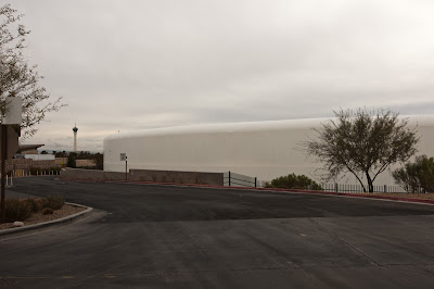
Today the spring, used by the water company, has been capped. Each cover is approximately one-hundred feet in diameter.

You can see a small spring in a man-made setting displayed for visitors. While you cannot camp there you can still have a meal at Wolfgang Pucks.

Click on photos to view a larger image

Spring in Current Setting


Vegas Spring Capped


Dining at Vegas Spring


Out of Las Vegas we took Hwy 159 through Blue Diamond then picked up Hwy 160 to continue our way west over the Mountain Spring summit.

Heading toward the Mountains


A Joshua Tree by the Road


Desert Landscape

From Mountain Spring Summit


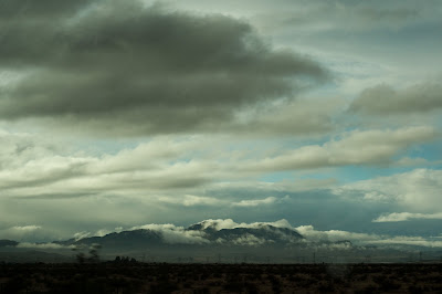
About fifteen miles farther we turned west on the Old Spanish Trail, leaving Nevada behind and traveling through the Pahrump and California Valleys, and the Nopah and the Resting Spring Ranges. The riverbeds were empty, but would soon be filled with water from the approaching storm.

According to Alonzo’s journal he was at Resting Spring on January 18, “We left 22 oxen today on the road, . . .they were unable to travel farther.” They laid over on the 19th, and Alonzo mended his frying pan handle. We realized that we were in the same spot on the same day, but 160 years later.

Resting Spring before the Rain


A few miles west we came upon the small town of Tecopa, CA.


West of Tecopa near the Armagosa River


Approaching Storm


We could view the storm coming from the west, and experienced occasional light showers. After Tecopa we traveled west until we met Hwy 127 that goes north to Death Valley. We turned south through the desert passing the Armagosa Canyon, the Salt Spring Hills, and the Silurian Valley to the east. We were crossing areas of Death Valley.

On January 25th Alonzo noted, “This morning 13 of us started with our packs on our backs for the settlements. We traveled 2 miles the winds and sand were so high and dead ahead that we had to lay by. It is almost 150 miles to Williams Ranch (current day Chino CA) and thirty (more) to Pueblo (Los Angeles). It wants an iron man to travel this country . . .We started and traveled until 9OCK and lay our bones down in the desert to rest without water. It is mighty hard for a poor man.” By packing ahead they could travel faster, and would also benefit those left behind because the short supplies would go farther.

We could not follow the trail further west as the Fort Irwin Military Reservation occupies the land. As we neared I-15 at the town of Baker we passed the dry Silver Lake on the right, and the dry Soda Lake is on the left of I-15.

The Mojave River, which originates in the San Bernardino Mountains, flows east through the desert near Barstow and Victorville. The river can fill Silver and Soda Lakes during heavy flooding.

The storm had delivered the promised rain, and we continued on the Interstate until we reached Barstow where we had an excellent pizza and spent the night.

Driving in the Rain


Clearing Skies near Barstow


Sunday, January 24, 2010

Mesquite NV to Las Vegas NV


On Monday, Jan. 18, 2010 we left Mesquite under ominous skies, and followed Hwy 170 along the Rio Virgin as did Alonzo and the Pomeroy Group. The Muddy River replaced the Rio Virgin and eventually empties into the present day Lake Mead, a man-made lake south of Las Vegas.

Click on photos for a larger image

Overcast Morning in Mesquite


The Rio Virgin


The Muddy River


Since we had a short-drive-day we decided to visit the Valley of Fire, a Nevada State Park.

Entering the Valley of Fire


Park Information


In the 1930s the CCC (Civilian Conservation Corps) built some cabins, for travelers passing thought the area, out of the native limestone.

Tourist Cabins


Cabin Fireplace


The landscape is truly remarkable and the colors, even on a dreary day, were brilliant. It is estimated that the valley was occupied from about 300 B.C. to 1150 A.D. Native Americans using the area range from the Basket Maker People and later the Anasazi Pueblo Farmers. Water is scarce in the valley so their stays would have been limited. Some excellent examples of Ancient Native American petroglyphs can be seen in various locations.

Mouse’s Tank was named for a renegade who used the area as a hideout in the 1890’s. It is a natural basin in the rock where water collects after rainfalls. Numerous examples of petroglyphs can be seen here

Road toward Mouse's Tank


Trail Leading to Mouse's Tank


Mouse's Tank


Petroglyphs


Emigrants passing this were unaware of the beautiful valley; they could not have navigated the terrain, and the lack of water would have made it an unattractive stopping place.

Rock Formations in the Valley of Fire

Align Center


Scenic Views


Looking for the Right Shot


Fire Canyon Sign


Silica Done Sign


We spent a good part of the day exploring the Valley of Fire, and finally left as the light was fading. We had entered on the east side of the park from Hwy169, but exited on the west side. We drove on I-15 to Las Vegas where we managed to spend the night without seeing a single slot machine.